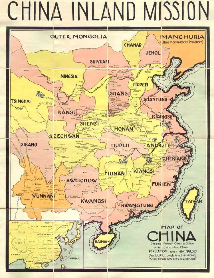
Among the documents in the Archives' collections are a perhaps infrequently used but valuable resource: maps of countries or locations where missionaries have worked. Usually these maps come in the midst of other administrative documents which tell the story of a mission agency's history. The map featured here, created in 1948, identifies Chinese cities and stations (villages, towns, rural centers) at which China Inland Mission (CIM) workers were based, quickly showing the breadth of the mission's activity throughout China's interior. Older maps of China such as this are particularly useful to staff and researchers because they allow them compensate for the evolution of Chinese placenames which occured during the 1900s, often due to or in response to the Romanization of names by Westerners. A placename referred to in a missionary letter like Anhwei may have only evolved slightly to Anhui, or from Peking or Peiping to Beijing, and most of China's current provincial names bear some resemblance to those on this map. But also possible is the change from Chowkiakow, where CIM missionary Helen Anderson who donated this map to the Archives worked in the early 1940s, to Zhoukouzhen. Compare a current map of China with this one and you will discover many other differences.
To read and understand Archives documents and the events behind them, researchers, staff, historians and living family members are now confronted with the task of crossing the bridge between currently and previously used placenames, which is how missionaries working in China referred to the locations as they were called when they lived there. This map therefore becomes not only a tool to envision the scope of CIM work and comprehend geographical location and proximity, but is also a link through time to identify previously used names for locations.
And the Archives has maps of many other countries too. So far, here is the list of maps found in Archives collections waiting for your exploration:
Maps--Alaska
Maps--Angola
Maps--Argentina
Maps--Bahamas
Maps--Belize
Maps--Bolivia
Maps--Botswana
Maps--China
Maps--Costa Rica
Maps--Ecuador
Maps--Guianas
Maps--Guyana
Maps--Honduras
Maps--Japan
Maps--Leeward Islands
Maps--Lesotho
Maps--Malawi
Maps--Mozambique
Maps--Namibia
Maps--Netherlands Antilles
Maps--Nicaragua
Maps--Paraguay
Maps--Philippines
Maps--Swaziland
Maps--Taiwan
Maps--Uruguay
Maps--Virgin Islands
Maps--Windward Islands
Maps--Zambia
Maps--Zimbabwe
Also see the digital version of Africa Inland Mission's map of East Africa. |